Category Archives: SCWP 2026

Mad dogs and Englishmen go out in the midday sun

Sunday 24 May 2026

Day 30 of walking
Falmouth to Portloe
Distance: 20.62 km
Total distance: 599.28 km
Climbing: 807 m
Total climb: 19,607 m

English summer arrived today. A cloudless, windless, sunny day. The forecast said it would get up to 22° but it felt hotter than that in the afternoon. The easy walking was in the morning and the harder walking was after 3pm in the afternoon with two up and down headlands to get over before Portloe. We were getting tired by then, ran out of water for the last half hour or so and were wilting in the sun but we are experienced enough to know we are strong enough mentally and physically to keep going.

The day started with an early breakfast at the Membly Hotel and then a 2km walk through the town to the ferry to take us to St Mawes. Falmouth was deserted with hardly a person or dog in sight. Such a contrast to the chaos of yesterday. The ferry was £11 each for the 25 minute crossing to St Mawes and there were about a dozen on the first sailing. The ferry can take up to 100. It chugged along slowly, about the pace I used to kayak! The water was like a mirror. The ferry ticket collector told us yesterday was the annual Castle to Castle ocean swim from Pendennis Castle to St Mawes Castle, a direct line swim of a mile, and the conditions had been ideal. I don’t know how they get on with boat traffic as the Carrick Roads are a very busy sea lane.

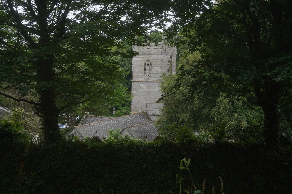
Coming into St Mawes you pass the matching Henry VIII Castle to the Pendennis Castle on the Falmouth side. At St Mawes you don’t even get off the quay. There is another little seasonal ferry service that takes you from St Mawes across the mouth of the Fal’s tributary, the Percuil River, to a place called Place. £6.55 each for a fast, short crossing. As we got off the first ferry we were hustled onto the second ferry that was just about to depart. Place has a large manor house with its own church. It was Sunday so we poked our noses into the church, unusual in that it has a cruciform plan.

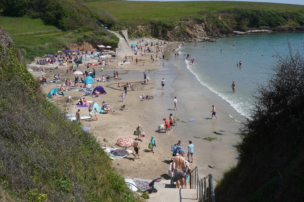
After leaving the church it was now 10 o’clock and we were just starting the day’s walk. It was easy walking along an undulating grass path passing a succession of small beaches. Porthbeor, Towan, Portscatho, Porthbean, Pendower. The ones with car parking were very popular and even the ones without, had plenty of users who were prepared to walk to their favourite, private spot. There were long lines at ice cream vans and cafes that sold cold drinks. A lot of people were in swimming and we took our shoes and socks off at Portbean Beach to cool our hot feet in the sea. We were wishing we had our swimming togs with us as the water was warm enough for us to have a dip. From now on they, and a small towel, will go into the day pack, along with the rain coats.

The last part of the day was hard because of the sun. There were short sections of woodland but mostly out in the open crossing fields. Nare Head and Manare Point were both hot, steep climbs, and just as you think you will never get there, Portloe appears, tucked into a tiny little cove. It has a narrow slipway, The Lugger, a very nice hotel we stayed at last time, a very nice pub, The Ship Inn, we ate at last time, a church and about 3 dozen houses. We are not staying in Portloe tonight, this is another one of our transfers. We were to meet Shane (female) at 5pm and she would collect us and take us inland to her Jago Cottages B & B, about a 10 minute drive away. We arrived in Portloe  a bit after 4pm, Barbara rang her, and she immediately came and picked us up. It is very comfortable and attached to her farm house. It has a fridge, toaster etc, things we don’t normally get. If it had a microwave it would be fully self-contained. It is not near any place for dinner and Shane offered to drive us back to the Ship Inn but we were too done to think about going out again. We knew about the dinner situation and bought a vegetable pastie earlier in the day in Portscatho to have for dinner. Sorry folks a pastie is just not worth photographing as dinner. When we arrived there was a slab of home made fruit cake waiting for us. It was woofed down before I remembered to get a photo of it.

Tomorrow morning Shane will drive us back down to the coast at Portloe where we continue our walking. This weekend is a bank holiday weekend and the weather forecast is for more of today, so we can expect the path and the beaches to be busy again.

A Nothing Sort of Day

Saturday 23 May 2026

Day 29 of walking
Mawnan Smith to Falmouth
Distance: 12.38 km
Total distance: 578.66 km
Climbing: 426 m
Total climb: 18,800 m

What a contrast from yesterday. We knew we had a short day today so we had a late breakfast and took everything very slowly. We didn’t leave until 9.45am and the walk was on a road, through a little woodland and then a paved footpath all the way to Falmouth. Our hotel tonight is at Gyllyngvase Beach which is about 15 minutes walking before Falmouth. It was only 4.75 kilometres from yesterday’s Trelawne Hotel to today’s Membly Hotel, which took us about 1½ hours, so we were there by 11.15 and check-in wasn’t until 3pm.

There are three charming little beaches between Mawnan Smith and Falmouth – Maenporth, Swanpool and Gyllyngvase. They are all very sheltered and popular with families, swimmers, kayakers and paddle boarders. It was a hot, sunny, windless day so they were going to get busy. We had previously swum at Gyllyngvase at this time of year and the water was freezing.

To fill in time we walked around the headland of Pendennis Point. The stretch of water between Falmouth and the land across the water at St Mawes is called Carrick Roads. The entrance to Carrick Roads, and Falmouth Harbour is guarded by two castles built by Henry VIII. Pendennis Castle and another in St Mawes. In 2018 we spent a day at Pendennis Castle and knew today it would be over run with visitors from the cruise ships, so we decided to keep well away.

Falmouth is a working port and holiday resort rolled into one. It is a sheltered deep-water port and so has a large ship building and repair industry, as well as being a major yachting centre. It has tall ship festivals and major yacht regattas and marinas with thousands of pleasure craft. We ate our lunch down on the waterfront near the National Maritime Museum and a large square filled with a craft market. There was also some form of performance going on with a large crowd standing around and loud outbursts of clapping and cheering every minute or so. We walked through the old part of town but it was awful. Too many people, too many dogs, too many vehicles trying to push through.

Two cruise ships were in Falmouth today. Falmouth is on the circuit of around the UK cruises. The Viking Saturn was at a dock and the Majestic Princess was anchored out in the bay. A continuous stream of orange tenders was taking passengers out to the Princess and back. There were probably an additional 5,000 visitors in Falmouth from the cruise ships and the town, bars, cafes, shops and waterfront were packed. You could tell the cruise ship people by their red (Viking) and blue (Princess) lanyards around their necks with their identity cards. There was also a fleet of buses taking them out on day excursions.

We went down to the Prince of Wales Pier to check out the Falmouth to St Mawes ferry for the morning. One of two ferries we will use tomorrow. Tomorrow is Sunday so there is only one ferry per hour and we want to get an early one. This is a regular, year-round service in a decent sized boat. All of the walking today was ‘urban walking’ except for a short stretch at the beginning in a quiet woodland. It was on paved surfaces, through a built up environment and close to busy roads. Such a contrast to the walking we have been doing in remote areas where you can walk for hours and not see a soul. This will change tomorrow when we cross the River Fal to St Mawes and the Roseland peninsula and we are back on a more remote coast.


Two boats and a bus

Friday 22 May 2026

Day 28 of walking
Coverack to Mawnan Smith
Distance: 22.21 km
Total distance: 566.28 km
Climbing: 668 m
Total climb: 18,374 m

What should have been a day of fun turned into a day of unexpected missed steps. This was supposed to be a 27km day and we decided this was too long so had researched a variation using a bus. Later in the day on arriving at Helford Passage instead of walking around the coast we could walk inland about 400 metres and get a bus to Mawnan Smith (a 5 minute bus ride) then a 15 minute walk along a country road and public footpath across a couple of fields to our hotel. Theoretically the hotel was in Mawnan Smith but it is actually in the countryside and a couple of kilometres away from the coast path. We were hoping to shorten the day by about 6km by using the bus. There was a bus every hour except for a gap between 2.10pm and 4.28pm.

We had an early breakfast at Fernleigh and were walking by 8.15am. The disadvantage in being the first on the path in the morning is that you get all the spiders’ webs in your face as you walk down the hedgerows. The weather was ideal for walking and it was easy for the first part around Lowland Point which is all of 5 metres above sea level. The path then goes through an abandoned quarry and turns inland to avoid a large working quarry on the coast. We were happily following the posts with the acorn signs and yellow arrows down quiet lanes and across fields when they just petered out. A bit confused we turned on the Macs App. This showed a different route that we were miles away from. We backed tracked to get onto the Macs route but it didn’t seem right so took a road to the coast at Porthhoustock. There we talked to a lovely lady who was a walker and knew the area well. She explained that the original ‘official’ route was the road we came down to Porthhoustock and then went around the coast to Porthollow. But that path had been damaged by storms and a new inland route, the Macs route, was devised. The coast route was now repaired and the Macs route was redundant. To complicate matters our Trailblazer Guide book (now 10 years old) had another slightly different route. The lovely lady put us right and restored our confidence but we were still two old people dazed and bewildered about what had gone awry.

Today there was one point of special significance to Coast Path walkers. At Porthallow is a large sculpture marking the halfway point on the South West Coast Path – it is 517km (315 miles) back to Minehead in Somerset and 517km (315 miles) forward to South Haven near Poole in Dorset. On one side of the sculpture is a list of flora and fauna that may be seen on the path, and on the other is a poem which commemorates the life of Porthallow and coastal Cornwall. We stopped here for a coffee break and of course had our photo taken.

A short walk further on was the obstacle of the inlet of Gillan Creek. One hour either side of low tide the creek can be forded. Otherwise you could take the path around the estuary, a walk of 45 minutes, or you could take the ferry. An enterprising boatman offers to ferry people across for £5 per person. He has a little dinghy with an outboard motor on the back. It is a seasonal operation and runs from sort of April to sort of October and depends on the tide. On the Gillan side of the creek is a little landing with a large folding square. Normally the square is folded in half and shows as black. If you want a ferry you unfold it so the it shows as an orange square to the boatman who is based on the other side of the creek. When he sees the orange square he putters across to pick you up. This worked a treat as we were only at the landing for a minute or two before he was on his way to pick us up. It is a crossing of only about 100 metres to St Anthony-in-Meneage on the far side which has a gift shop and another of those lovely country churches. The boatman required to be paid in cash and this is the first time we have used cash since we arrived in the UK just over a month ago.

After a quick look in the church we set out on the path but were soon stopped by a notice on the first gate. The path to Helford Village was closed due to fallen trees and root plates. We knew Cornwall had been hit by a cyclone a few months ago and many places, including St Michael’s Mount, had lost a lot of trees. This meant the path around the coast was closed but the notice had a coloured map showing an alternative inland route on roads to Helford Village on the bank of the Helford River. We took a photo of the map for reference and set out. It turned out to be a nice walk on a very quiet country road. Narrow, just one lane wide, and with high hedgerows either side, not a road we would usually like to walk on, but it was faster and easier walking than the coast would have been.

Helford Village across the Helford River to Helford Passage is another ferry ride, this time in a slightly bigger boat that had a partial cabin and is a more commercially run year-round operation. It is a longer crossing than Gillan Creek, cost £7 per person, and accepted card payment not just cash. This ferry had an orange disc system instead of a square and when we turned up the ferry was on its way to our side to deliver some passengers, so good timing there. We were at Helford Passage at about 3 o’clock and the bus, only 400 metres away, wasn’t due until 4.28. To fill in time we went into The Ferry Boat Inn and did another first for this trip. We bought a coffee! So far this trip we have had coffee at our accommodation and a flask coffee on the walk, so we can have it when and where we like. The don’t make a Long Black as we would know it in NZ. In the UK they make an Americano which is an upside down long black but only one shot and far too much water. We found you can order a double shot espresso with a little jug of hot water and get the nearest thing to a long black. Coffee here is also expensive, two double shot espressos are £7.50, which is about NZ$18.

The bus was on time and the walk to the Trelawne Hotel was easy but we didn’t arrive until 5pm which is late for us. This hotel is a bit upmarket from what we have become used to. Dinner was a quite formal affair with all the staff in white shirt/blouses and black trousers. The food was excellent and beautifully presented and for the record Barbara had roasted cod loin with sauté seasonal greens, sweet and sour capers and peppers and sauté potatoes. I had pan seared pork tenderloin with apple and celeriac remoulade, teryaki sauce and parmentier potatoes. Each came with vegetables: broccoli, carrot, beans, corn and something else.

So today had a lot going on, we are past the halfway mark, wandered around fields confused, two ferry rides, a closed path with diversion, used some cash, bought a coffee, a bus ride and being hopelessly underdressed for dinner. I didn’t bring a tie and Barbara didn’t bring her pearls.


On a clear day you can see forever

Thursday 21 May 2026

Day 27 of walking
Lizard to Coverack
Distance: 19.32km
Total distance: 544.07km
Climbing: 699m
Total climb: 17,706m

On a clear day you can see forever, but not today. When we left this morning Lizard was shrouded in mist. Austin and Linda at the Caerthillian said it would burn off but it was not to be. Back down at Lizard Point we could barely see the lighthouse but sure could hear its sound. Every thirty seconds a blast. It was very directional though. In bed last night I could hear it faintly but down on the coast on the seaward side of the lighthouse it was very loud. Apparently they typically emit a specific. rhythmic pattern that allows sailors to identify which lighthouse they are hearing.  This lighthouse was not a deep low frequency groan but more of a high pitch whistle.

The South West Coast Path Association says ‘this is a section of cliffs and coves, punctuated by headlands giving excellent views along the coastline. Here and there are areas of sandy beach at the foot of the cliffs’. This could well be true, we will never know. All day we hardly knew we were on the coast. The mist rolled in off the sea, up the cliffs and across the meadows. At least there was no wind or rain today and it was warmer for that.

From Lizard we passed the murky outlines of the lighthouse, Lizard Wireless Station (another site of Marconi’s pioneering work in wireless telegraphy) the Lloyds Wireless Station and the Bass Point Coastguard Watch. At the Watch the volunteer opened his window for a brief chat, mainly about the weather. I think we were the first walkers he had seen this morning.

We passed the new RNLI life boat station. This has a building at road level, a cable car down to the boat house and then a long slipway that disappeared into the mist but presumably went into the sea. We did see the dramatic collapsed cave called The Devil’s Frying Pan, This has a narrow hole through the rock with a narrow land bridge over it. Then the tiny fishing village of Cadgwith, a collection of lobster pots, fishing floats and boats clustered around a single pub. This village had a very high proportion of cottages with thatched roofs.

From Cadgwith we soon came to the ruins of the Serpentine works, a once-thriving Victorian serpentine rock factory. The Lizard area is the largest outcrop of serpentine in Britain. It is part of the earth’s mantle which would normally be about 20km below the surface. The rock has streaks of blue, green and red, reminiscent of a snake’s skin giving the rock its name. Local sculptors still carve ornaments from the colourful rock. The only beach we crossed today was at Kennack Sands which had the usual surf hire shop, cafe, life guard, car park and toilets.

From the beach it was fairly easy walking on low cliffs. The mist lifted for a while and then descended again. Just before reaching Coverack we had two options, both official Coast Path routes. The first was to continue around the coast, the second was to go inland and through a sculpture garden. The coast wasn’t offering anything today so we went the inland route. The Terence Coventry Sculpture Park is set in three small meadows surrounded by trees and with an outlook over the coast. It is a free sculpture park and celebrates Coventry’s life as an artist and as a rural farmer. There are about 25 large works in metal and stone representing rooks, owls, swallows, bulls, cows, horses, dogs, as well as people. It is a beautiful, quiet, peaceful setting, such a contrast to the dramatic rugged coastline.

Tonight we are in Coverack at the Fernleigh B & B. On arrival Anne made us a fresh pot of coffee and some home made lemon drizzle cake. In our room were also home made chocolate cookies. It is yet another of those nice little Cornish fishing villages going about its business without the crass commercialism of some others. There is a little harbour with boats sheltered behind a tall stone quay wall, a cafe, a community grocery store, a gift shop, fish and chip shop and a lovely pub called the Paris Hotel, named after a liner that ran aground here.

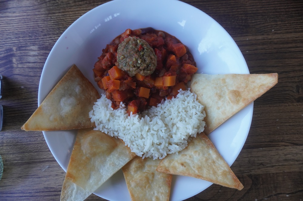
We had dinner in the Paris Hotel. Barbara: 5 bean chilli with rice, homemade tortilla chips and fresh salsa, Paul: chicken Shawarma, marinated chicken, flat bread, tzarziki hummus. vegetables, fresh salsa, jalapenos and fries. We stayed in this hotel last time and loved it. It is on a low point right by the sea and eight years ago as we ate dinner a pod of dolphins swam by.

Overall today was another good day despite the white out. No rain, no wind and warm enough. Late in the afternoon the mist had gone and it was a beautiful warm, sunny evening. We felt good after our day off in Lizard. Having rounded Land’s End and Lizard we now have a lot more woodland, hedgerows, flowers and a feeling you are not quite as exposed to the elements.

Coverack to Mawnan Smith is going to be a fun day, so don’t go away folks, stick around and come back tomorrow.

Extra:

In the last little while we have seen signs like: The Western most point in England, the Southern most point in Great Britain, the best crab sandwich in the British Isles, the prettiest beach in the United Kingdom etc. So what do these place names actually mean?

United Kingdom – a political sovereign country made up of England Scotland Wales and Northern Island (but not the Republic of Ireland – a separate country).

The British Isles is a geographical term for a group of over 6,000 islands including England, Scotland, Wales, Northern Ireland, The Republic of Ireland, and Crown Dependencies (Isle of Man, Guernsey and Jersey).

Great Britain is England, Scotland, Wales and their associated islands – but not Northern Ireland or the Republic of Ireland.

Britain is just a shortened version of Great Britain.

England, Scotland, Wales and Northern Ireland are distinct constituent countries making up the sovereign state of the United Kingdom.


Wake up Maggie

We have an app on our phones called Map my Walk. We have the limited free version which basically measures the distance walked, the time, the route taken and the elevation gain. There is a subscription version which does a lot more including workouts from your trainer, sharing with friends, the weather (temperature, humidity, wind speed and direction), analysis of your walking etc. It will measure the number of steps taken, stride length, cadence, foot strike angle etc. There are also versions called Map my Run and Map my Ride.

We want the app to accurately measure the distance we have walked each day. The distances in our Macs Adventure notes and the various guide books are woefully inconsistent. They also only give distance on the Coast Path not adding in the often considerable distance to your hotel, path diversions and us getting lost. We used the app on our four 20km walks in Wellington before we left home to check its accuracy and it is pretty good.

As we are about to start walking we activate the app and a female voice says:

Start workout.

At each kilometre she says for example:

Time, five hours forty three minutes twenty one seconds

Total distance, 18 point zero kilometres

Average pace, fifteen minutes seventeen seconds

Split pace, thirteen minutes nineteen seconds

Then silence until you have walked another kilometre.

In Wellington we found this annoying. We thought she was nagging us and called her Naggy Maggie and turned the sound off. But here we love to hear her and now she is Maggie our friend and walking companion. It is really motivating to hear each kilometre ticked off. Barbara keeps her phone in a pocket of her day pack and we can hear Maggie without having to look at the phone screen. Barbara is getting very good at predicting just when Maggie is going to pipe up.

Maggie’s voice is obviously AI generated and is a little bit mechanical I imagine her as an Asian lady with an American accent.

It is interesting to see how your pace varies during the day. In the morning on a good surface we don’t go faster than about 12 minutes per kilometre. In the afternoon on a long steep climb or descent with lots of steps or a slippery surface this can go out to 27 minutes a kilometre. It also makes a difference if you have a tail or head wind.

If we stop for coffee, lunch or to talk with someone for more than a few minutes then we have to remember to pause workout or else the pace becomes meaningless. And then we have to remember to restart workout to set her off again.

On three occasions just as we have arrived at hotel reception to check, in Maggie has piped up with Time, five hours etc. The person on reception has looked a bit startled until we turn Maggie off and explain who that strange voice is.

Flat out like a lizard on a log

Wednesday 20 May 2026

Rest day number four Lizard

This was a restful day. A slow, late breakfast where we had a long talk with a lady from Switzerland who is touring around Cornwall/Devon in her car with her wee dog. She is doing day walks on the coast and next goes to St Ives then Padstow. She came over from Europe on the “chunnel”, the channel Tunnel. It takes 35 minutes from Coquelles in France to Folkstone in England and a train runs every 15 minutes, 365 days a year. You do not directly drive your car through the tunnel you drive onto a specialised train and sit in your car for the length of the crossing. We told her we were in Switzerland in 1978, before she was born, and we went on the train from Jungfrau  through the Eiger Mountain to Europe’s highest railway station. She said she lives very close to the Jungfraubahn (the railway).

After doing our “rest day laundry” we retraced our steps from yesterday afternoon to the Coast Path and walked the last little section to Lizard Point, the southern most point in mainland Britain. This is very low key compared to Land’s End. Some information boards, UK’s most southern cafe, a couple of small souvenir shops, the old lifeguard station and a slipway down to the sea, and that’s about it. Some distance away the Lizard Lighthouse, a car park and toilets. The Lizard Village is about a 15 minute walk inland from the point.

We had lunch in the very nice Coast Coffee Bar and Bistro in the heart of Lizard. CFC (Coast fried Chicken) crumbed chicken, salad and fries. Cod burger with fries. It was hard to find anywhere that did not just do seafood dishes which seems to be the thing in Lizard.

There is no grocery store in Lizard, you have to go to Helston 18 kilometres away, for us a day’s walk each way. By chance we went into a hidden away Farm Kitchen and Cafe and they stocked enough food for us to get fruit, yoghurt, baguette , biscuits etc for tomorrow.

Later in the afternoon I went out to find the St Wynwallow’s Church, another one of those wonderful old village parish churches I love to poke my nose into. This one had a few interesting things to offer. As is usual it is surrounded by a cemetery of ancient gravestones. Like a growing number of places the grass is just left to grow. The church has the grass mown three times a year and at present is supporting “no Mow in May”. This is a conservation campaign to encourage gardeners to put away their mowers and let the grass grow wild, allowing early spring flowers like daisies, dandelions and clover to bloom creating a vital nectar and pollen source and shelter for early season pollinators like bees and butterflies. Next month the campaign is “Let it bloom in June”.

St Wynwallows had a nice warm inviting feeling to it helped by the light coloured stone, dark timber, bright red carpet and two very fine stained glass windows. Capping it all off were brightly coloured tapestry kneelers on the pews for all the congregation. Each one was an individual design, some simple designs, others more complex, some commemorating events or loved ones. No apparent overall theme to it, a lot of dedicated people just doing their own creative thing.

On the floor in the church is a large bell, among the oldest pre-reformation bells in Cornwall and over 600 years old. It formed part of a chime of three bells used up until 1937. The two others are still in use as part of a peel of six bells that have been used since 1938. One of the original bells still in use is stamped with the Royal Arms as used from 1189 to 1340. The bells still ring out at least three times a month and they are looking for new bell ringers –  not campanologists, they study the art and science of bell ringing.

So we are rested up and ready to hit the path again. Seven days walking until our next rest day in Looe.


Progress Report

Progress Report No. 2


We have now reached Lizard and have walked 524.75 kilometres and climbed 17,007m. This is the equivalent of walking from our apartment in Wellington to Te Rapa on the northern outskirts of Hamilton and climbing Mt Everest nearly twice.

The Lizard is another milestone as it is the southern most point in mainland Britain. From Land’s End we have been going east but now we will also be going slightly north.

There is now a background weariness even when we have a good night’s sleep and a good rest. But we are still enthusiastic about keeping going.

Dot Dot Dot

Tuesday 19 May 2026

Day 26 of walking
Porthleven to The Lizard
Distance: 23.85kms
Total distance: 524.75kms
Climbing: 735m
Total climb: 17,007m

Today was a very windy day and by the time we reached The Lizard we were feeling quite battered. At times the wind gusts were up to 60km/hr. Leaving Porthleven there were large swells coming in and smashing against the quay. Going out past the clock tower we had to run the gauntlet of waves crashing over the wall onto the road. This part of the coast is prone to huge seas and there are fantastic videos on line of waves crashing over the clock tower.

A short distance up the coast is Loe Bar. This is a shingle bar that separates a fresh water lake, known as the Loe, from the sea. It is Cornwall’s largest freshwater lake and was formed about 800 years ago when the River Cober was dammed by the shingle bar. We could walk across the bar today but in 2018 we had to walk a diversion as the path was closed. Large earthmoving machinery were digging a trench across the bar to lower the level of the lake. The diversion was 8km around the edge of the lake. A very nice walk in woodland but you don’t want to add 8km to an already demanding day.

Next point of interest was the church of St Winwaloe, also known as The Church of the Storms. St Winwaloe was an abbot who came from Brittany, France in the sixth century and founded the first sacred place on this site. There has been a church here since the 14th century or earlier although storms have caused havoc and there have been many restorations by the community over the years. The church huddles behind the dunes at Gunwalloe and we huddled behind the church to shelter from the wind while we had our coffee break.

Just beyond Poldhu Cove is a monument to Guglielmo Marconi and his team who transmitted the very first message ever to cross the Atlantic by wireless. In 1901 a morse signal was sent from here and received in Newfoundland Canada. The signal consisted of a repetition of the Morse letter ‘s’ ie dot, dot, dot. The wireless station operated here from 1900 until 1933.

Yet another tiny fishing hamlet at Mullion Cove and a long stretch of very easy flat walking that took us inland away from the cliffs before Kynance Cove. The beach here is always in the list of top 10 beaches in Cornwall and probably England and the UK. It has several small white sand beaches among jagged rocky headlands, caves and stacks. Even on a windy day like today with huge seas on the coast, these beaches were calm. On a sunny day the water is a brilliant turquoise blue but sadly not on the overcast day today. The rocks are made of red and green serpentine stone. This cove is hugely popular in summer even though it is a steep 15 minute walk down from the car park. If you do a Google search of Kynance Cove you will see it at its best.

Between Kynance Cove and Lizard Point we turned off the Coast Path and walked into Lizard village where we are staying for the next two nights at The Caerthillian, a lovely blue and white painted house in the heart of the village. Lizard is not pretty, quaint or historical. It has a Bohemian feel to it with brightly painted houses and home-made sculptures on front lawns. Tomorrow we have a rest day here and will take the short walk down to Lizard Point and the lighthouse.

There aren’t many eating options in Lizard and we have flown half way round the world and walked 500 kilometres around the coast to eat Mexican at Chimichangas Tex Mex Street Food. We had loaded nachos with veggie bean chilli, nacho cheese, cheese, pico de gallo, jalapeno and sour cream. Also loaded burrito bowls with pulled pork and pineapple, rice, guacamole, pico de gallo, sweetcorn, nacho cheese, sour cream and homemade nachos. And it was damn good. Presa bueno.


XXXX?

Monday 18 May 2026

Day 25 of walking
Penzance to Porthleven
Distance: 18.81km
Total distance: 500.90km
Climbing: 584m
Total climb: 16,272m

Today we took a bus. From our hotel in Penzance, 4.5km to Marazion. Our purpose was to make the walk today an hour shorter. 12mm of rain was forecast from 3pm so we wanted to ensure we got to our destination Porthleven before then. The walk from Penzance to Marazion is dead flat on the top of a paved sea wall. The beach on your right and the Great Western Railway, Penzance to Piccadilly London, railway line on your left. It also goes through some commercial and industrial estates so not the most interesting of walks. We didn’t actually save an hour because we had to wait 15 minutes for the bus and then it took 15 minutes to get to Marazion, so a half hour saved but we did start fresh from Marazion.

We rationalised this by thinking in the last 24 days we have walked 482.1kms. The South West Coast Path Association have the distance as 439.9kms, so we have walked an additional 42.2kms. Spread over 24 days this is an extra 1.8km per day. This is due to diversions because of path closures, getting to and from our accommodation from the path, and us getting lost. We reckon we can give away some of our additional 42.2km walked by sometimes getting the bus.

When we went down to breakfast there was light drizzly rain in Penzance and it was pretty bleak. By the time we checked out the rain had stopped, but on the bus to Marazion it started again and it continued for about the first kilometre of walking. From then the weather improved all day with just the occasional spots of rain and we got to Porthleven dry at 2.30pm before the forecast rain. It has now been raining lightly since about 4pm.

We discovered a new hazard today. Sometimes the path is very narrow and on the right side is a cliff or hedge. On the left side is a 5 strand barbed wire fence with each strand having barbs at 100mm centres. Today in places it was often windy and sudden strong gusts would push you off balance. I had been saying to myself a mantra: don’t grab the fence, don’t grab the fence, don’t grab the fence. But then if the wind does make you trip, stumble or fall maybe a gashed hand is better than a sprained ankle or twisted knee. The hand may have to be sacrificed for the greater good of being able to continue to walk. Then there are the single wire fences that separate you from the cows in a paddock. Every now and then there is a little tag on the fence that says Beware Electric Fence.

Macs Adventure let us down today. We were booked into The Artist Loft in Porthleven. We knew this was Airbnb type self-contained accommodation and there would be no one to check us in and we would need to collect the key from a key safe. The address was in Fore St above Stargazy Gift Shop and Nosebag Café. We went up and down Fore St looking for these shops but couldn’t find them. Eventually we saw a high level sign for The Artist Loft but it was above Just Lily Gift Shop and the Twisted Currant Tearooms. The previous shop and café were long gone. Our instructions were to go to the rear of the building, up some stairs and there would be a wooden cupboard opposite the front door. Inside the cupboard would be a lock box and our access code to it was XXXX. We thought this was a bit odd as lock boxes usually have a numerical code. Inside the wooden cupboard was not one, but five lock boxes and each had a name: Tregonning, Saltcellar, Harbour View, Penrose and Loe Bar. We were now totally confused. Luckily a very obliging young man, Robin, turned up. He was a sort of property manager for the building and thought the information Macs had given us was non-sensical. He was able to phone the travel company who managed the letting of the accommodation. They had a record of our booking, room name and numerical code to get the key from the lock box. So that all turned out well thanks to Robin. Strangely our bags were in the room so the luggage transfer company knew what room we were in and how to get the key.

It was a fairly easy walk today starting by walking along the edge of Mount’s Bay dominated by the iconic sight of St Michael’s Mount. Due to the rain it was not at its magnificent best today. We spent a wonderful day out there in 2018 so did not have a visit included this time. Mount’s Bay was left behind and after low cliff walking Praa Sands (pronounced “pray” locally) was crossed partly on the beach and partly on a sealed road above the dunes. We walked through an area of old mine workings with several engine houses and chimneys. The Wheel Prosper Tin Mine and the Trewavas Copper Mine. The last section was the hardest of the day with climbing and descending on a rugged path and a strong wind.

We are in Porthleven, another lovely Cornish village by the sea. It has a harbour built by prisoners from the Napoleonic wars as manpower. It was once a busy pilchard fishing port but today its prosperity depends on tourism.

The Artist Loft does not serve breakfast so for the only time on this trip we have to fend for ourselves in the morning. None of the cafes and tearooms open early enough for us so we purchased some supplies at the local grocer and will eat in our room. Tonight we went out to the traditional old Harbour Inn for a meal. For those who want to know: steak, beef shin and tribute (beer) pie, gratin potato, buttered carrots, beans and broccoli, red wine gravy.


Life is short, eat more apple pie

Sunday 17 May 2026

Day 24 of walking
Porthcurno to Penzance
Distance: 20.71km
Total distance: 482.09km
Climbing: 642m
Total climbing: 15,688m

Now that we have rounded Land’s End the climate and flora have changed. We are now walking in an easterly direction and not exposed to the weather coming across the Atlantic Ocean. It could be described as sub-tropical. There are still exposed rocky headlands to cross, small sandy coves below and areas of huge boulders but mostly we were walking through vegetation so lush it sometimes formed a tunnel, woodland of stunted oaks, and the wild flowers are back after having gone awol for at least a week.The first place of interest was the tiny fishing village of Penberth which is entirely free of tourists and it seems we are an intrusion on the fishermen living and working there. There is a now disused 19th century capstan which was used to haul boats up onto the beach.

After climbing another headland it was a descent to the forested valley of St Loy. This would be the greenest, lushest valley we have seen so far. The path goes right to the beach and there is about 100 metres of walking over large stones. Off shore was a Coast Guard boat that seemed to come and check out a fishing boat. The fishing boat was back and forward across the bay with a flock of sea birds in tow. Next was the lighthouse of Tater-Du. This is a fairly new structure built in 1965 and has never been manned, it was automated from the start, and so there are no adjacent keepers accommodation or support buildings. Tater-Du is Cornish for ”black loaf”, after the rocks below.

After the lighthouse is the privately owned hamlet of Lamorna. There is a café serving ice creams, coffees, teas, cakes, pasties, toasties and soup. It is a popular place as a lot of day walkers come over the headlands from the nearby Mousehole. We each bought an apple pie with Cornish clotted cream, to go. At the top of the next headland we sat on the grass in the shelter of a boulder and that was our lunch. Earlier we had stopped for our “coffee from a flask” at a memorial to a tragedy in 1981 when the cargo ship Union Star and the lifeboat Solomon Browne were wrecked on the cliff below in hurricane force winds. All the crew on both ships perished, a total of 16 men. North Devon and Cornwall have always been dangerous waters for seamen. In the area around Land’s End alone there are 149 recorded wrecks.

Mousehole (pronounced “mowzell”) is exactly the romantic notion of what a Cornish fishing village should look like. The name possibly comes from the Cornish mouz hel, or Maiden’s Brook, or maybe because the entrance to the harbour is so narrow that getting through it is like trying to sail through a mouse hole. Whatever, it is perfectly picturesque with a high quay wall, sheltered harbour full of small boats, surrounding stone cottages, narrow winding streets, old inns and tiny shops. It was a former pilchard fishing village but now has an overwhelming influx of tourists.

Just along the road is the real working fishing village of Newlyn which refuses to turn itself into a nostalgia trip for the benefit of tourists. It is gritty and grimey and is the largest fishing port in England. When we were in Lisbon two years ago we learnt a lot about the earthquake of 1755 that destroyed most of the city. The earthquake caused a tsunami to strike the Cornish coast, 970km from the epicentre. In Newlyn the sea rose 3 metres in 10 minutes and ebbed at the same rate. More trivia: Newlyn was the last port of call in England (for water and supplies) for the Mayflower before setting off for America.

Tonight we are in Penzance at The Longboat Inn, another nice old pub and hotel. Walking into Penzance there was a shower of rain and as we didn’t want to go out again tonight, we went into an Aldi superstore and each bought a super processed factory meal. They each have over 60 ingredients, most of which you have never heard of, and a best by date in about 2 years. Barbara’s was a Raku Smoky Chicken Salad and mine was a Raku Chicken Shawarma Salad. You can see the ingredients list in the photo.

Last time we were in Penzance we had an extra day and went out to St Michael’s Mount in Mount Bay. This is a great place to visit. At high tide you go out or back in a little ferry, at low tide you can walk across a stone causeway. This time however we move on tomorrow, so no time to go out there again.

PS we haven’t seen any pirates in Penzance yet. Penzance must hate Gilbert and Sullivan.